
This is a continuation from my previous post, Timberline Trail Attempt: Day 1.
I was so exhausted from Day 1 that Bailey and I were in our tent at sundown. I’m terrible about staying up late enough to appreciate the stars when I camp, and that’s something I need to be better about. On the plus side, I get plenty of sleep on every trip! We were awake with the sun, by design: early starts would hopefully make for easier river and creek crossings with lower water levels.
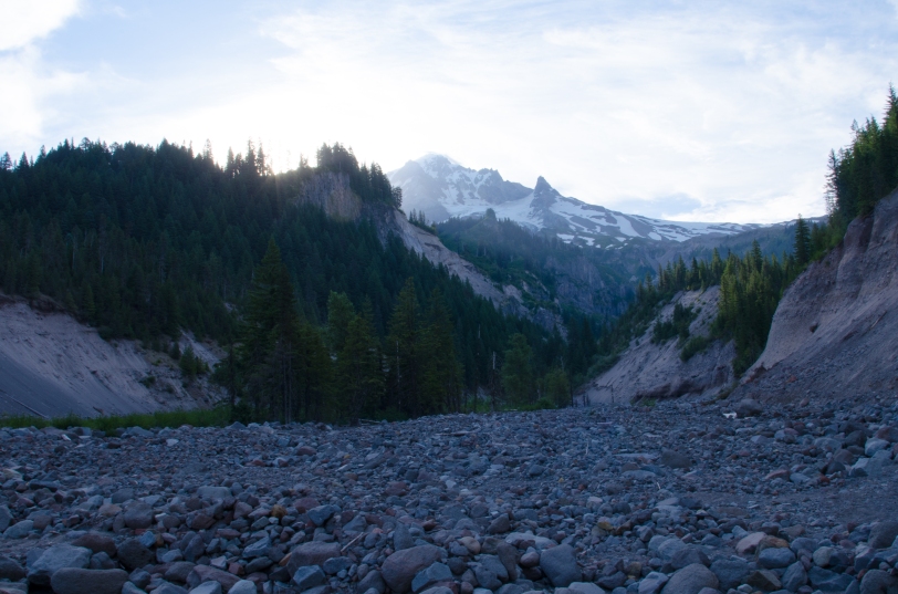
The first of these river crossings had been a part of our overnight soundtrack, as we slept near the Sandy River and it rushed past over rocks and boulders. The water is so silty you cannot see through it, making it impossible to judge the depth. We walked up and down the bank, and I tested a few spots with my trekking poles; the river yanked on them, thin as they were. Another solo hiker approached from the opposite sides, and we pointed back and forth (we could not very well hear each other yelling over the river) considering the best place to cross. Meanwhile, a pair of hikers came up from my side and seemed to pause only a few seconds before striding in and crossing confidently. They made it look easy. The solo hiker across from me shrugged, and came across – much more slowly and carefully than the pair had gone, but he made it. The water came up to the knees of these other hikers – and I’m short. I was nervous, and Bailey was sticking to my heels. With a deep breath, I stepped into water that came to my calves and stuck my pole out into the current…
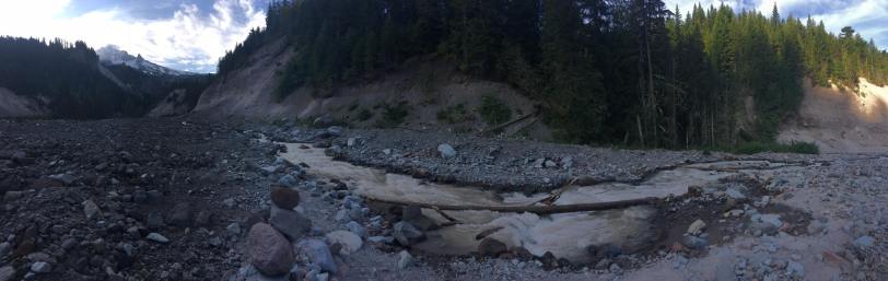
The water was not nearly as cold as I had expected. My pack hung from my shoulders with the waist and chest straps undone, just like all the safe crossing instructions I’ve read said to do. I made sure each foot and pole was firmly in place before I made my next step, always having three of the four points in contact with the river bottom. Bailey’s pack was off her completely, and I’d thrown it to the other side of the river so she would be unencumbered and I didn’t have the extra weight. For two steps, the water came up to my thighs but then I was through the deepest part and quickly out on the opposite bank. Bailey swam across right behind me with little encouragement, instinctively going up against the current and seemingly have less trouble than I did. We’d done it! My most difficult water crossing to date was done, and it was one of the most difficult on the route. It was a heck of an adrenaline rush and confidence booster.
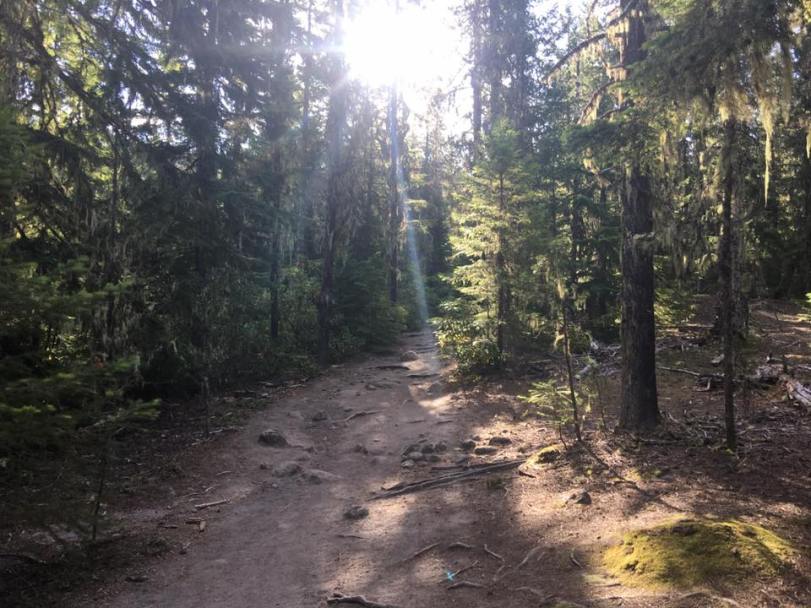
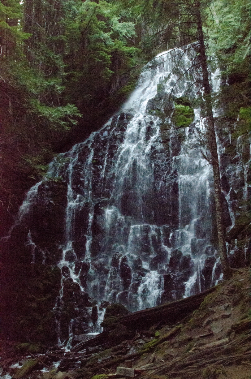
After exploring a little bit of the area (so the sun could dry us out a bit), we headed into the woods and along the trail to Ramona Falls. This beautiful waterfall draws many visitors, but being a Wednesday morning meant lower traffic and we had them all to ourselves for a bit. It was a place I’ve always wanted to see but avoided because of crowds, and I was pleased to get some solitude in which to appreciate it.
Ramona Falls was the lowest elevation point we would hit along the Timberline Trail, and we immediately started climbing back up through the forest. We did encounter just a couple other solo hikers; one coming along the PCT, and another down from Yocum Ridge (he said the views were incredible). The trail was overall in good shape as we gained elevation, until past the Yocum Trail intersection. We began encountering small streams that eventually fed into the Muddy Fork, and some sizable washouts along the trail. The terrain felt stable enough, but it was a long way looking down in those areas. I was especially thankful for our clear, dry weather as I am sure I would feel differently crossing the same areas in the rain. Blow down was minimal, although we did encounter some downed trees. Wildflowers dotted the hillsides all along the trail, some different than we’d seen the day before.


The route I’d opted for, sticking with the traditional Timberline Trail and not taking alternate or shorter distances, took us around Bald Mountain. We crossed several branches of the Muddy Fork, some of which were easy and some a bit more challenging (but nothing like the Sandy!). At those trickier crossings, there were often cairns – stacks of rocks – and brightly colored ribbons to mark easier crossings identified by previous hikers.
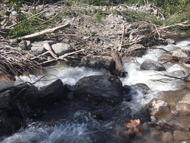
At one particularly difficult spot (it was deep), four other hikers came across from the opposite direction as I was scouting for where to cross. They were stopping for lunch, and two came back down to offer Bailey and I assistance. Initially I declined, because I am stubborn; but after a moment, and asking if they were sure they did not mind getting wet again, I accepted a hand across. One spotted us and the other set himself at a deep point to give me a hand across. (They were easily a foot taller than I was; knee deep on him was again thigh-deep on me.) They had offered to carry Bailey, but she swam the short distance with no issue. It was a good reminder for me, both in accepting help from others and that the hiking community in the region is wonderfully supportive.
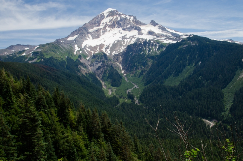
Where most of our day had seen few other people along the trail, after we crossed the Muddy Fork on the approach to Bald Mountain and, beyond it, several trail intersections, we began running into an increased number of hikers. Another PCT hiker was among these, who had hiked all the way from Mexico; he said it was cool that I was doing the Timberline Trail, and I thought he was very kind to say so. We also encountered a pair of elderly women hiking along the trail who really gave me an emotional boost by asking about the hike and providing some sincere encouragement. They were a pleasure to talk to, and made sure I would stop to look behind me as I went to catch some great views of Mount Hood at a particular point. Again, that hiker community. I did encounter others throughout the trip who had less than helpful things to say; I use those to fuel me, too, because I am determined to prove them wrong when they express doubt in my abilities. Plus, when I got to that view the pair of ladies had told me about, it was awesome to see how far I’d come already. Bonus, I felt like a bad ass knowing I’d crossed the river so far behind and below me.
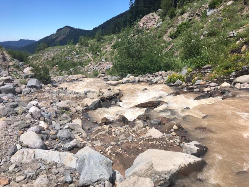
The trail after rounding Bald Mountain was almost all uphill; occasionally, it would level out for a very short distance. It was also full of trip hazards in the form of giant rocks and roots, and very, very warm. A couple of times, creeks crossed out paths. We passed alpine meadows and ponds formed by snow melt. We were getting closer to our evening destination: Cairn Basin. There was one more significant (but relatively easy) crossing at McGee Creek where some logs aided us in keeping feet mostly dry.


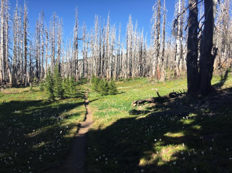
The trail led us through meadows teaming with flowers, and towered over by the charred remains of forest. The Dollar Lake Fire had burned through in 2012, and we would see evidence of it for miles ahead. Near the edge of the meadows, where we could hear another significant creek just over the ridge, we set up camp beneath still-living trees. We were perfectly positioned to hit our next big crossing early the next morning. But first, we needed some much deserved sleep!
As always, you can visit my Flickr site for more images from my trips and comments are definitely welcome. Check back for reports from Days 3 and 4…

Pingback: Timberline Trail Attempt: Days 3 & 4 | PDXBirdNird