
This is a continuation from Timberline Trail Attempt: Day 1 and Timberline Trail Attempt: Day 2.
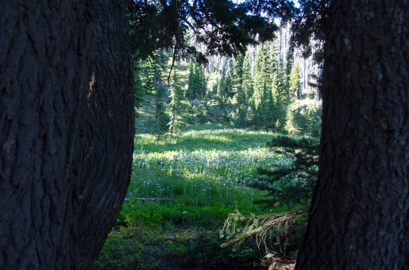
Day three started with waking up surrounded by meadows full of flowers as the sun came up, and the sounds of nearby Ladd Creek waiting to be crossed. As we packed up camp, another solo hiker with a notable red pack went by – a man we encountered not long after as we got to the creek, looking to cross himself. We both moved up and down the bank, testing the depth with trekking poles and climbing around on the rocks to get a view of upstream & downstream options; eventually we picked a place and spotted each other as we went across.
A couple of comments about being glad to have another person there were shared, and we set off separately; except, we stayed pretty close together with similar hiking speeds and break habits. He also takes pictures of signs, proving I am not the only one! We ended up aiding each other (Bailey, too, of course) across three more crossings that day. Mark and I chatted more throughout the day, sharing a couple backpacking tips we’d each picked up as we went after our own ambitious hiking goals. We moved through miles burned by the Dollar Lake fire in 2012, leaving ash in addition to all of the glacial silt (think sand) and making for a throat-drying, dusty hike. Still, the views were breathtaking.
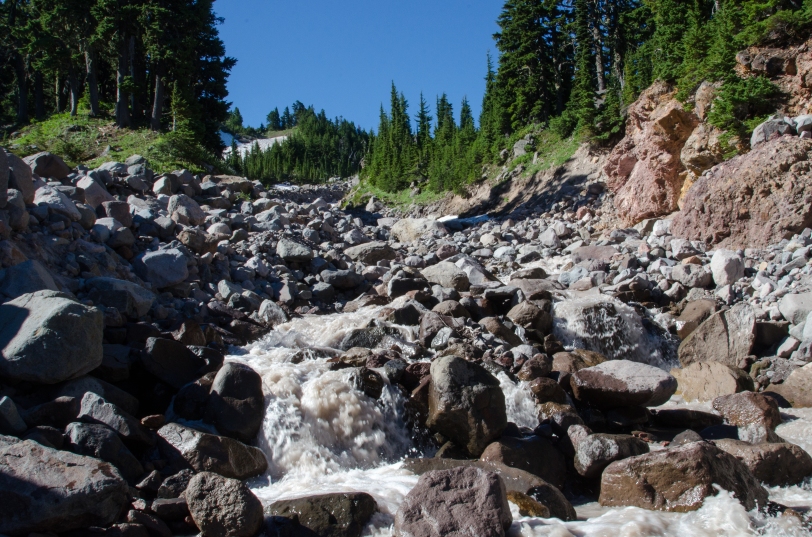
There were several opportunities to get our feet wet on day three! We next reached Coe Creek, about three miles into the day. Mark opted to go try out the snow bridge over the creek, but Bailey and I opted to go through the water. Considering we could see it coming straight out from under the snow, it wasn’t as cold as you might expect! Not long after, we reached Compass Creek – there are a couple branches, only one of which was a challenge, but smaller than some of the previous ones. More dusty, uphill miles in the sun gave us amazing views but also needed lots of breaks along the trail! Bailey is getting good at the “take a break” command we’ve been working on.


We reached Cloud Cap shortly after crossing Eliot Creek, which seemed fancy after a couple of days on the trail: there are picnic tables and running water! A note for next time a rugged trail takes me to a front-country camp site: use the bathroom, and dump your trash (in the proper receptacles of course)! I was so happy about the easy access to water, I didn’t even think about the other opportunities. We visited for a bit with the other six hikers we’d met at the Eliot Crossing, where Bailey got a ton of attention and praise (which she totally deserved).


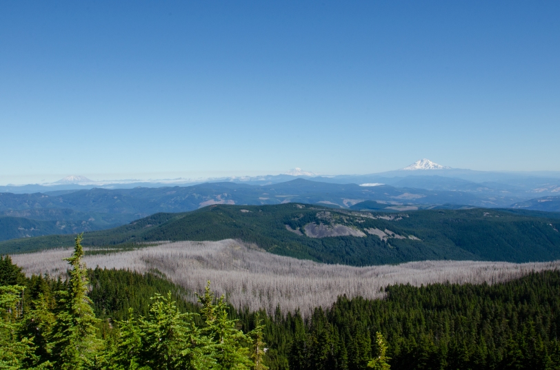
Then it was back on the trail for more elevation gain, more dust-and-ash trails, and more spectacular views. We took an alternate, parallel trail up a ridgeline that was like climbing a rocky sand dune, and could see clear out over the Columbia River and spot the giant white windmills in Eastern Washington. Down the other side of the ridge, we could see where the Eliot started as glacial runoff from the Eliot Glacier. Before sunset, we used a cutoff trail back to the Cooper Spur Shelter; camp was a flat area behind a boulder for some shelter, surrounded by some low shrubby trees. I was so tired, I forgot to take a picture of the view as the sun went down.
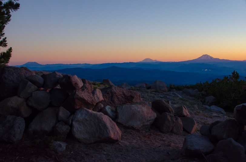
This is my last picture from our last day on the Timberline Trail, taken at sunrise from the tent. You can see Mount Saint Helens, Mount Rainier, and Mount Adams on what promised to be a beautifully clear day. We’d camped near fellow solo-hiker Mark, and headed early up the Cooper Spur trail which took us to approximately 8000′ elevation (completing that trail would’ve been at over 8500′).
It was still early, and I knew that as fast as the ground was heating up, I needed to get Bailey off the mountain. She’d developed a blister on one paw pad, but being the trooper that she is she followed me clear back down that ridge at nearly double-time so I could get her into shade as fast as possible. (We took breaks in every spot of shade we could find, from boulders and trees alike, on the way down to avoid overheating.) I loaded her with praise and treats as we went to keep her going, feeling guilty with every step because my number one goal on the trail is to keep her safe and healthy. I was so concerned about her, I never paused to take another picture.
We went back to Cloud Cap where we could wait with shade and water for a ride back to the car at our starting point. It was bittersweet to know I absolutely made the right call in quitting the trail.
With a few days of rest and pampering, Bailey was fine after our adventures around Mount Hood. There was no feared dampening of her spirits for the trail – she’s as eager to go as ever! We’ll be heading back around the mountain to try again, better prepared for the conditions and armed with new experience.
As always, you can visit my Flickr site for more images from my trips and comments are definitely welcome.
